
In Johannesburg
Services in Johannesburg
- Cholesterol and You
- Motivational Speaking
- Soweto
- Rubble Removal
- Bee Removals
- Furniture Removals
- Storage on East Rand
- Document Storage
- Photographers
- Photography
- Antiques
- Chocolate Fountain Hire
- Chimney Cleaning in Johannesburg
- Skip Hire
- Debt Wise
- Bookkeeping
- Don't get left in the dark
- World Class City
- 3D Printing
- Accounting
- The Sweet and Snack Expo
- Molex
- Women in Construction
- Vintage Style
- Hydraulics
- Security
- Industry
- Team Building
Products in Johannesburg
Life in Johannesburg
- Your Weekend
- Kyalami Kart Circuit
- Alive and Well in Johannesburg
- Belly-dancing
- Sparrow Village
- Randpark Ridge
- Soweto Tours
- Northcliff
- Ferndale
- Bee Story
- The Battle of the Service Providers
- Johannesburg - West and South
- Building in Johannesburg
- Parkhurst
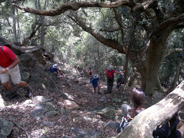
Hikes Near Johannesburg
Article updated on 27 August 2018
What hikes are there near Johannesburg
Being South African, we have the bush bug in our blood, we just love the outdoors. The problem is that we don't have much time for recreation and exercise. Fortunately there are some wonderful hikes near Johannesburg that are convenient to get to.
There are a number of hiking trails to choose from, some far and some near. Melville Koppies is a real gem because of its proximity and variety of terrain.
Hikes near Joburg:
- Hennops Trail Hikes
- Suikerbosrand Nature Reserve Hikes
- Melville Koppies Hikes, near Johannesburg CBD
- Bergheim Holiday Resort and Hiking
- Klipriviersberg Hiking Trail
- Walter Sisulu Botanical Gardens Hikes
- Castle Gorge Hike, Magaliesburg Mountains
- Shelter Rock Hike in Magaliesberg
- Klipkraal Hiking trail
- Phaladingwe Day Hike
- Uitkyk Hiking Trail, near Hartebeespoort Dam
The Johannesburg Hiking Club, www.jhbhiking.co.za, also has information on hikes near Johannesburg. The hiking club also organises ocasional hikes. Contact Angela Raine Telephone Number: 078 885 6505
Security on hiking trails in Johannesburg
Security is an issue on hiking trails in Johannesburg as it is very difficult for the police to respond to "the robbers are near the big stream near the bluegum trees". Basic safety precautions:
- When hiking in a group, split up the group and keep 50 to 100m between the two groups. If one group gets robbed, then the second group will be able to call for assistance.
- Always carry a cheap cellphone to call for help
- Know who to call. Have the hike organisers cellphone number as well as the police (10111)
- Avoid wearing jewellery
- Carry a licenced firearm and know how to use it.
Hennops Trail North of Johannesburg
| Distance from Johannesburg: | 48 km |
| Time from Johannesburg: | 53 minutes |
| Google Maps: | Directions to Hennops Hiking Trail |
| Cost: | R60 adult, R30 child. No need to book, just arrive. 082 825 9205, www.hennops.co.za |
| Duration of hike: | Short Hike: 2km, 1 hour Medium Hike: 6km, 2 hours Long Hike: 11.5km, 4hours |
Suikerbosrand Nature Reserve South of Johannesburg
| Distance from Johannesburg: | 70 km |
| Time from Johannesburg: | 50 minutes |
| Google Maps: | Suikerbosrand directions |
| Cost: | various costs. 011 439 6300, more info |
| Duration of hike: | 0 to 24 Hours, 66 km network of trails |
Melville Koppies Hike, near Johannesburg CBD
| Distance from Johannesburg: | 0 km |
| Time from Johannesburg: | 0 minutes, it is in Johannesburg |
| Google Maps: | |
| Cost: | R0. Melville Koppies East and West is open to the public. Melville Koppies Nature reserve requires a donation, usually R20 or more. |
| Duration of hike: | 0 Hours to 4 Hours, 1km to 20km- there are many interconnected paths |
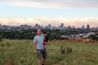
Above: the Melville Koppies West Hiking Trail
Bergheim Holiday Resort
| Distance from Johannesburg: | 135 km |
| Time from Johannesburg: | 114 minutes |
| Google Maps: | directions to Bergheim Holiday resort |
| Cost: | for more information Tel 014 537 2363, www.placesforafrica.com/bergheim |
| Duration of hike: | 3 Hours,8 km |
Klipriviersberg Hiking Trail
| Distance from Johannesburg: | 10 km South of Joburg CBD |
| Time from Johannesburg: | 15 minutes |
| Google Maps: | Klipriviersberg Hiking trail |
| Cost: | R0 |
| Website: | www.klipriviersberg.org.za |
| Map: | map of Klipriviersberg or this link |
| Duration of hike: | 0 to 8 Hours, 8 to 20km |
Walter Sisulu Botanical Gardens West of Johannesburg
| Distance from Johannesburg: | 20 km |
| Time from Johannesburg: | 32 minutes |
| Google Maps: | Directions to Walter Sisulu National Botanical Garden, Malcolm Road, Poortview, Roodepoort |
| Cost: | R60 adult, R30 child. No need to book, just arrive. |
| Duration of hike: | various |
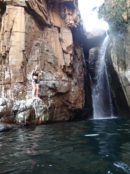
Castle Gorge, Magaliesburg Mountains
- 20m waterfall
- 12km moderate difficulty
- hour’s drive from the north of Johannesburg
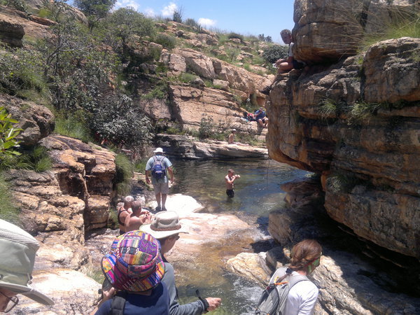
Photos courtesy Steve from Meetup.com
Shelter Rock Hike North of Johannesburg (near Magaliesberg)
| Distance from Johannesburg: | 65 km |
| Time from Johannesburg: | 1hr 10 minutes |
| Google Maps: |
Gates open at:
|
| Cost: | R80 adult, R35 child. No need to book, just arrive. |
| Website: | www.shelterrock.co.za/hiking.html |
| Duration of hike: | 3 to 5 hours. 8km, 400m elevation |
After the hike, try out the Black Horse Restaurant. At the registration office you will receive a very detailed booklet on the history of the area.
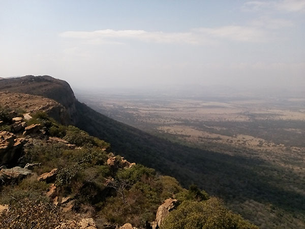
The view from the top of Sheter Rock Hike
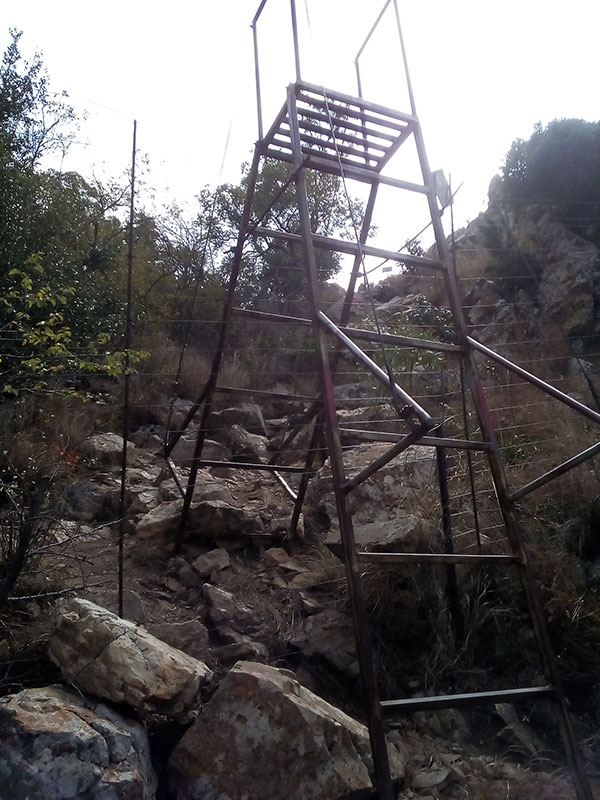
The stiles are probably the scariest part of the Shelter Rock Hike
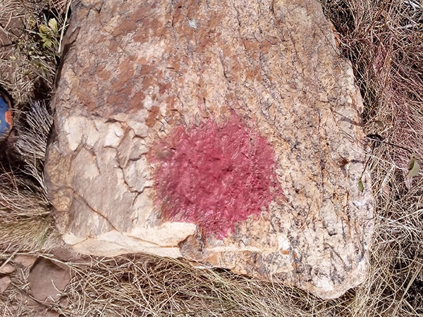
Shelter Rock hike is VERY well marked out with red Pteradactyl droppings.

Locals getting amorous in public
The actual Shelter Rock
Toilet facilities are hygenic at the start of Shelter Rock hike
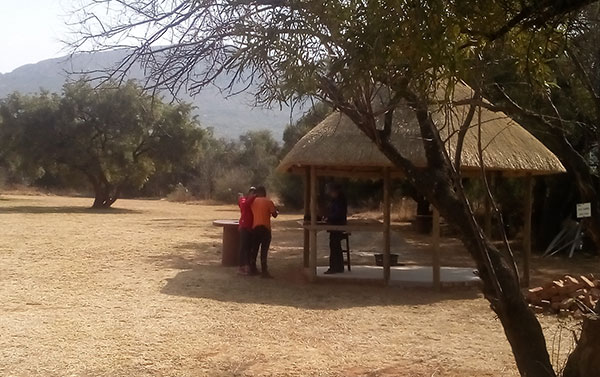
Registration "office" for the hike
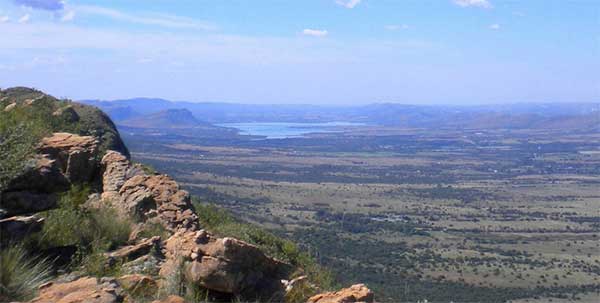 Shelter Rock Hike view
on a clear day
Shelter Rock Hike view
on a clear day
Klipkraal hiking Trail (near Vaal)
| Distance from Johannesburg: | 80km |
| Time from Johannesburg: | 1hr |
| Google Maps: | Directions to Klipkraal Hiking Trail -26.7947635 28.2267977 |
| Cost: | Bookings: Maurice and Celeste Leonard +27 16 372 1432 or 083 412 5272 |
| Website: | http://www.footprint.co.za/klipkraal.htm |
Phaladingwe Day Hike (near Pelindaba)
| Distance from Johannesburg: | 54km |
| Time from Johannesburg: | 46min |
| Google Maps: | Directions to Phaladingwe Day Hike -25.7990331,27.9067324 |
| Cost: | R50 (2018) |
Uitkyk Trail, near Hartebeespoort Dam
| Distance from Johannesburg: | 61 km |
| Time from Johannesburg: | 65 minutes |
| Google Maps: |
S25 42.333 E27 50.714 |
| Cost: | R60 per person, minimum 6 people per group. R51 booking fee. Call 0861 522 262 (update: in august 2018 we could not get in touch of the booking agency) |
| Duration of hike: | 4 Hours, 7.5 km |